Mountain Bike Reviews Forum banner

Do I need a computer and if so which one?

1 reading
5.5K views 37 replies 18 participants last post by  wolfmw  
#1 ·
Aloha Internet Mountain Bike Riders!

You know me or have at least disagreed with one of my posts. I’ve got a 2023 Trek Fuel EX Gen 6, which I think is the pretty cool. I’m normally rely on my iPhone and Apple Watch for tracking my ride. I’ve tried the Cyclemeter App, which is really good, but I’m thinking I want something more roughed, durable and less of a problem if it gets busted up when I go over the bars…

I was thinking a Garmin, Wahoo, Hammerhead or even Lezyne computer mounted to my handlebar, pointing out where to turn next, or how step this hill is, etc.

Here are a few other details…
  • I want to link the bike computer to my iPhone and Apple Watch if possible.
  • I don’t Strava and don’t plan to.
  • My bike is kitted out Shimano XT (if that matters).
  • The computer should have a reasonable price.
  • Doesn’t need a color display, gray scale is fine.
  • I might be buying Ant+/Bluetooth cadence and speeds sensors (which I want link to the Bike computer and iPhone).
  • At the time of this posting, I plan to use this computer exclusively on the Fuel.
  • But… The more I think about it, maybe the computer will find its way to my other bikes.
Image

(image used to increase engagement)​

I also want to avoid my bike computer becoming self-aware and taking over the world with a surprise nuclear attack followed by an army of chrome robots. I’m watching you AI…
 
  • Like
Reactions: flgfish
#2 ·
Easy and cheap to get additional mounts for the other bikes, I swap my Garmin between 5 bikes. I like Garmin, they are not cheap though. Lezyne is less expensive, has less refined connections to other 3rd party apps like RideWitheGPS, TrailForks, Kamoots, etc…. Wahoo is OK, somewhat basic screen map display. Hammerhead is very refined, just has crappy battery life at around 12 hrs, and no direct connection to TrailForks. If you do not need a lot of performance metrics like power, and other items, the Garmin Edge Explore 2 is $250 or so, maybe $300. Is a bigger unit, does a good job displaying maps, color on map is essential, better defines what info you are looking at and pretty much all the units hve color maps this point,
 
#3 ·
What do you want the link to your phone to actually do?

Many can connect to your phone via bluetooth, but this is done for specific functions. I only use it for uploading rides and only occasionally. So I leave the connection off (to save on battery for both devices) unless I'm specifically uploading a ride.

I tried the connection once for weather alerts and wasn't thrilled with how that turned out. I saw the sky getting gnarly before the devices started feeding any alerts.

What is a "reasonable price"? Judging by your bike, I'd guess your reasonable price is higher than mine. But impressions based on stuff like that can be wrong.

Why would you link your sensors to both the gps and the phone? If you're using the bike computer to record your ride and give you information, just link the sensors to the bike computer. The phone doesn't need that information. Not to mention, many sensors will not output to 2 different devices at the same time.
 
#4 ·
Garmins use a phone app called Connect Mobile. It BT connects to the cycling device, grabs a completed ride data and sends it up to the Garmin Connect website and if you choose, up to a different activity tracker like Strava, RWGPS, etc, Wahoo works the same way. They can also port over software updates amd are used to get navigable routes sent to the device. Hammerhead uses WiFi directly, can use a SIM card, or a phone hotspot, there’s no on phone app for Hammerhead,
 
#5 ·
You’re feeling the need for some retail therapy?

What exactly do you expect to do with a screen?

don’t you already have enough screens? Maybe mtb time can be your chance to be in the world.

;)
 
  • Like
Reactions: fredcook and Ezra E
#7 ·
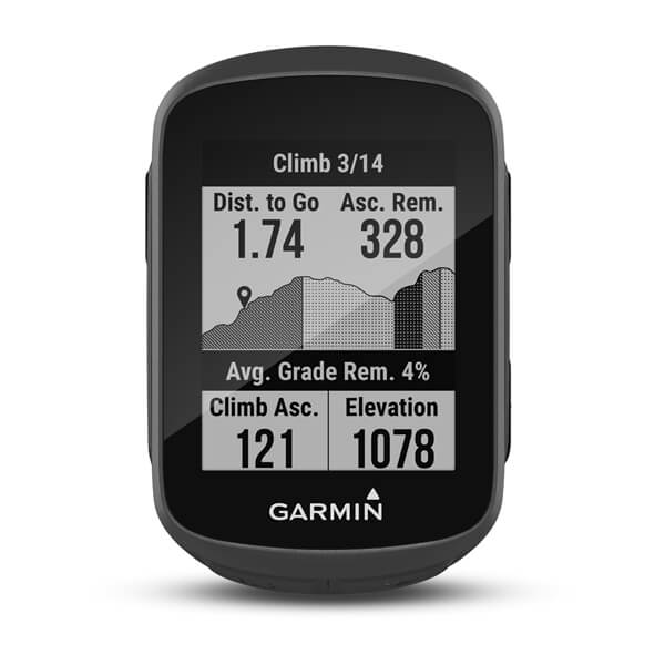
You can always just get something basic like a Garmin Edge 130. It can pair with your iPhone through Garmin Connect and can also connect to other Ant+ devices. I use a Garmin Instinct watch...and its paired with my phone.

 
#9 ·
Garmin Edge, highest number you can afford or want to spend. I mount mine on my mtb w/ a K-edge “gravity cap” mount, out of the way and super secure. Swap it to a handlebar mount on my gravel bike.

only complaint I have about my 530 is the elevation is always off, especially if it gets wet/humid - not ideal in here in Hawaii! I think that may be improved in newer models.

The Wahoos look nice but no personal experience.
 
#19 ·
I find the 530 is the sweet spot on price & features. I don't particularly like the touch screen and they are problematic with certain weather, gloves, etc.

You are very right with the elevation data. I live in a humid area of south LA and thunderstorms do weird things to the barometer (which is what Garmin uses for elev. calculations). I'm a remote sensing scientist and deal with GPS/GNSS daily, I haven't understood why Garmin doesn't use published elev. data (like Google Earth, etc.) My only conclusion with GPS devices for fitness activities, is the data doesn't have to be super-accurate on the horizontal and vertical (because none of it is).
 
#10 ·
What do you want the link to your phone to actually do?
I was thinking I'd upload trail maps.

The Apple Watch capture all the details I can manage. I'm not at the point in my life were I need power numbers and what not. I just like to see my ride, and boost about how cool I am.

What exactly do you expect to do with a screen?
The map is the big deal. When out on the MTB, I don't need to know how fast I am or my power output. I need the map and/or the went it time to turn. That data is nice for road rides, but I in the woods its the fun that matter most to me. I guess that's type 1 fun, while road riding is more a type 2 fun.

Also, if it's not on Strava, it didn't happen.
I know.
 
  • Like
Reactions: noapathy
#15 ·
I was thinking I'd upload trail maps.

The Apple Watch capture all the details I can manage. I'm not at the point in my life were I need power numbers and what not. I just like to see my ride, and boost about how cool I am.


The map is the big deal. When out on the MTB, I don't need to know how fast I am or my power output. I need the map and/or the went it time to turn. That data is nice for road rides, but I in the woods its the fun that matter most to me. I guess that's type 1 fun, while road riding is more a type 2 fun.
That’s the rub for me. Have you tried reading trail maps on those tiny screens? When I really need to navigate I’ve got the phone and an offline map app, or even a photo of a topo.

I understand having a map readily available is important in some situations, for example if you’re racing an unmarked course, but just riding along a tiny bike computer is another piece of gear you don’t need.

At least try before you buy - I was actually shocked how bad they are for the money.
 
#11 · (Edited)
I've used Garmin and Wahoo.

It's been 6-7 years since I used a Garmin, so my knowledge of their software might be out of date, so YMMV.

Garmin's software on your computer is bloated and kludgy - you have to install multiple apps, some of them want to run in the background all the time, the UI is clunky. But it works, and is comprehensive and full-featured. It also syncs to the computer and all the social services. It's more expensive, but you're basically getting into an ecosystem, and that has benefits.

Wahoo puts the whole UI onto their mobile app, which is clean, easy to use, and minimal. So, configuring the unit on the bike you go through the phone, which is easier and better. It integrates with the various social things (i.e. Strava) the same as a Garmin, but getting the files to your PC requires going in to the unit like a USB drive and grabbing them manually. [Edit: this is wrong, see WER304's post on page 2] The only desktop app available has a paid subscription, for training programs.

I think Garmin is worth the price if you want a one-stop shop that does it all, but Wahoo is worth it if you want to integrate it in to 3rd party apps that you prefer using now. Like, I use an app called 'rubiTrack Pro' to manage my saved gpx files on my Mac, because I prefer the UI.

If I go on another long-term bike tour, like 6+ months, I'll look at my options again - I think the Garmin package may be superior for that - but for the trail riding and bikepacking I do now, the Wahoo is sufficient.
 
#30 ·
I've used Garmin and Wahoo.

It's been 6-7 years since I used a Garmin, so my knowledge of their software might be out of date, so YMMV.

Garmin's software on your computer is bloated and kludgy - you have to install multiple apps, some of them want to run in the background all the time, the UI is clunky. But it works, and is comprehensive and full-featured. It also syncs to the computer and all the social services. It's more expensive, but you're basically getting into an ecosystem, and that has benefits.

Wahoo puts the whole UI onto their mobile app, which is clean, easy to use, and minimal. So, configuring the unit on the bike you go through the phone, which is easier and better. It integrates with the various social things (i.e. Strava) the same as a Garmin, but getting the files to your PC requires going in to the unit like a USB drive and grabbing them manually. The only desktop app available has a paid subscription, for training programs.

I think Garmin is worth the price if you want a one-stop shop that does it all, but Wahoo is worth it if you want to integrate it in to 3rd party apps that you prefer using now. Like, I use an app called 'rubiTrack Pro' to manage my saved gpx files on my Mac, because I prefer the UI.

If I go on another long-term bike tour, like 6+ months, I'll look at my options again - I think the Garmin package may be superior for that - but for the trail riding and bikepacking I do now, the Wahoo is sufficient.
With a Wahoo bike computer there are a few ways to get a .ride fit file across to your PC.

The easiest one is to have a free Dropbox account and link that to your Wahoo account. You can then have the Wahoo bike computer automatically save a copy of your ride .fit file straight to the Dropbox folder on your PC or Mac where it will be ready to access.:)


Image


If you have the Rubitrack Pro IOS app installed on an Apple device you can also tap directly on the “Share .Fit File” button, as shown in the picture above (Wahoo Elemnt IOS app - History - select a completed ride - tap on the Upload button in the top right corner of the screen to get this screen up) and it will import it directly into the Rubitrack Pro IOS app.
 
#12 ·
You haven't really said what you want it for but my recommendation would probably still be the same whatever.

I'd suggest the Garmin Edge 840.

I've had a Garmin Edge 1000 (touch screen and not recommended) and currently use a Garmin Edge 530 (buttons are OK but I want buttons and touchscreen).

The 840 has both buttons, a touchscreen and a fast operation. For navigation, the touch screen is really useful for scrolling the map. Scrolling a map with buttons gets tedious very fast.

When riding though the buttons are really useful to change screens, etc. quickly especially when it's raining. My old touchscreen used to lock up when that happened. Generally a UI based on touch is a pain in the arse when you're moving.

I've used mine for long multi-day tours, bike packing and overnight rides. If you put it into battery saver mode you can get really long run times.

The modern Edges have a nice fast UI, fast route planning and long battery life. They're much more reliable than older models and worth the money IMHO.
 
#28 ·
You haven't really said what you want it for but my recommendation would probably still be the same whatever.
I don't think I knew, until I stated to read review of bike computers. I think the most important aspect of a bike computer for me is navigation. My idea is my friends and riding buddies decided to try Cosmic Decline* next weekend. I could upload the trail from Trailfork, All Trails, komoot, etc... So while we ride I have some idea of where I am. The Apple Watch and iPhone to collect that data that I'm already collecting (but honestly rarely use).

Right now I'm focused now the Garmin Edge Explore 2 and the Element Bolt V2 and the Garmin Edge 530 because of its (my) wallet friendly price. A big thanks for all the suggestions from this thread (thank you everyone).

I haven't picked a winner, but I have an idea of what I'm looking for in a bike computer and a few ideas that might work for me.

* Cosmic Decline isn't a real trail I know of, I just came up with the name on the fly... but I think its a cool name.
 
  • Like
Reactions: sgltrak
#13 · (Edited)
I use a Garmin 840. I like the flow, grit, and cycling dynamics info specific to MTB. Cycling dynamics is data about your jumps, air time, distance.


The compact size of the 840 works well with a stem tube mount.


I also use the 840 with my Tacx trainer and road bike. You can create a profile for each of your bike to really hone in on the different info the particular bike can provide.

It handles ANT+ sensors easily.

My wife uses a 1040, it's the size of a small cell phone. One feature I really like is the group ride, it shows me where my wife is on the map. This gives me peace of mind.
 
#21 ·
Up until the 830 started showing up around this price I'd have mentioned the Wahoo Bolt v2 as a viable alternative. It kinda makes me wonder if there'll be a similar price drop coming since a lot of people seem to like their interface. (or maybe it has and I've missed it since I'm not actively shopping for any of these devices)
 
#18 ·
I was thinking I'd upload trail maps.

The Apple Watch capture all the details I can manage. I'm not at the point in my life were I need power numbers and what not. I just like to see my ride, and boost about how cool I am.


The map is the big deal. When out on the MTB, I don't need to know how fast I am or my power output. I need the map and/or the went it time to turn. That data is nice for road rides, but I in the woods its the fun that matter most to me. I guess that's type 1 fun, while road riding is more a type 2 fun.
When you say "trail maps", what exactly do you mean? If you're referring to the trails themselves, there are certain, specific ways you can get specific routes to show up via a phone connection. I don't know all the details because I don't use mine this way. If you mean reference maps that show an entire network of trails and the terrain and roads and whatnot around it in case you need to make route adjustments on the fly, no, you won't be loading those onto your device with a phone connection. Some computers will have some level of reference map like that preloaded (which may or may not be useful), but if you want to add layers (such as a trail network layer) to it or replace it, then you're going to need a computer to connect to.

I use a Garmin watch and/or a phone app to record my rides, but I never look at either one during a ride. I still use paper maps to tell me where to turn when in unfamiliar areas.
I have a basemap of my region loaded onto mine, but yeah, I very very rarely look at it. I, too, use paper maps when good ones are available and if not, will pull use my phone. And that doesn't involve connecting my phone to my bike computer in any way.

The maps on my device really only come into play if I program a route onto the computer so I'm getting navigation prompts. I program routes in such that I don't need reference maps (turn prompts are programmed into the "course" file in garmin parlance), but those reference maps are sometimes handy for that purpose.
 
#22 ·
Maybe this will be helpful ...the most useful functions of my bar/stem mounted bike computer, given that I am also tracking the ride on my phone which is typically in my rear bib pocket:
  • Maps ...I like to explore quite a bit and thus being able to glance down at a map is required ...currently just looking at black and white crappy maps ...will upgrade to color this year
  • Time of day ...my local rides have many different options and the one I take is frequently dependent on how much daylight is left
  • Distance Remaining ...only available if using a route ...I have a bunch of routes that I only do occasionally and have frequent distance options. I like to know how much further to go so I can reroute or pace myself better
  • Racing ...I like to load the course so I can better pace myself if there are significant climbs ahead
  • various sensor data such HR, Power, Cadence, but I'm becoming less and less interested in these things
 
#32 · (Edited)
I don't think I knew, until I stated to read review of bike computers. I think the most important aspect of a bike computer for me is navigation. My idea is my friends and riding buddies decided to try Cosmic Decline* next weekend. I could upload the trail from Trailfork, All Trails, komoot, etc... So while we ride I have some idea of where I am. The Apple Watch and iPhone to collect that data that I'm already collecting (but honestly rarely use).

Right now I'm focused now the Garmin Edge Explore 2 and the Element Bolt V2 and the Garmin Edge 530 because of its (my) wallet friendly price. A big thanks for all the suggestions from this thread (thank you everyone).

I haven't picked a winner, but I have an idea of what I'm looking for in a bike computer and a few ideas that might work for me.

* Cosmic Decline isn't a real trail I know of, I just came up with the name on the fly... but I think its a cool name.
something to keep in mind given your use scenario - Garmin has good integration with Trailforks and comes with trail maps loaded. But although the device comes with maps, you have to update them. Or I guess to put a more positive spin on it, you can update them! I remember it being kind of a pain in the @ss and not intuitive to figure out.

For a relevant example (assuming you're on Oahu based on Diamond Head in the background of your bike pic ;) ), when I got my Edge 530 only the main Ohana trail showed up in the Olomana area, even though many more exist and are documented on Trailforks. After a map update, most of the trails are there. Probably due for another update now that a few more have been built and appear on TF.

BUT... you only get the "sanctioned" trails (at least around here, may depend on how carefully the admins for a particular region screen what goes on TF). Yeah I know we're all good stewards and only ride official, documented trails. But let's say you wanted a break from Pupukea or Ohana and wanted to ride an undocumented but well known local spot like Cosmic Lewis* where the Cosmic Decline* trail is, you're SOL.

Honestly, like others have said I usually find it easier to just whip out my phone and use the Trailforks app if I need it. The screen on the 530 is pretty small. But I love it for data recording. I do synch it with Strava, but that's certainly not a requirement. The Garmin Connect app is pretty good, and/or you could synch it to Trailforks or probably all kinds of other stuff.

*not a real place. But IYKYK ;)
 
#33 ·
Thanks Wolfmw!


Image


Side note about that picture. That big warehouse looking building behind the tall palm trees, is where Disney was filming the live action "Lelo and Stitch" movie, until the Hollywood strike. Disney rolled-up production very quickly in the first week of the strike. One of the production team made chalk drawings on the shoreline walk near by. I wish I took pictures of them... Anyways, if the movie ever makes it to Disney+ when you can see the 'Aliens' wearing belts. Those belts are inter tubes from the LBS I spent the summer working for. Also the LBS (me) helped with the camera 'dolly', it uses HIGH END road bike wheels. It needed a quick and simple fix, but none of the crew were riders.


As for the computer, I'm looking at the Garmin Edge Explorer 2. Keep in mind Garmin will announce an Explorer 3 as soon as I buy the Explorer 2. I understand there are limitations of the Explorer, system. If I go for it, I'll get the base model, the power model is a little to pricey, and I think for my lifestyle the 16 hour battery is enough for me. Every other device I use spends the night on a changer why not add a bike computer.

I'll have my phone with me when I ride, but in my hydration backpack were its safer than my handlebar. The need to stop to check my phone seems ok to me (in theory). I do have concerns that there will be difficulty in loading the trails I want to explore, but at this point I have to roll up my sleeves and try it (and find a how to online).

I would like to thank everyone for the help. I'm still not 100% settled, I might just abandon the whole idea, when I see the next new shiny must have thing the industry puts in front of me... Titanium shoelace eyelets, anyone?!
 
#34 ·
Honestly on my local trails, I have most of them memorized at this point (especially the ones closer to home that I ride more often) and only pull out maps to show other people the trail network. And for that, the bigger the better. And I live in a notable riding destination with a few hundred miles of trails available. Not sure how long you've been riding your local trails, but I'm sure there will be a point you reach where you memorize your favorites, too.
 
#35 ·
I mainly use my computer for heart rate. I have a pretty good idea when I am warmed up, going to blow up or max that I can still recover before going hard again.

I could do it on my watch but harder to monitor.

Another use is being able to radio in location when separated while NICA coaching. That more distances than map.
 
#36 ·
So... I did it. I combined some free shipping, a gift card and signing up for a "newsletter" discount and ordered a Garmin Edge Explorer 2, Friday. (I'm calling it a birthday gift to myself.) It showed up today, as I was walked out the door to work on a new bike rack for my pickup truck. It's like everything was going my way (for at least 8 minutes today. )

Currently my iPhone is "sending software update" . I've mounted the Explorer using a Trek BlendR mount to secure the to my handlebar. It looks pretty good.

I posted this same question to the local FB MTB group, but I wanted to float it here too: What trail mapping platform do you use and why, Komoot, TrailForks, Alltrails, RocketMortge, Strava, etc?
 
#37 ·
I posted this same question to the local FB MTB group, but I wanted to float it here too: What trail mapping platform do you use and why, Komoot, TrailForks, Alltrails, RocketMortge, Strava, etc?
I use a few different sources depending on what I'm after.

I have my Garmin Connect account connected to Strava and RideWithGPS both, so my rides go both places automagically. I use Strava mostly out of momentum these days, but the social aspect of it is nice sometimes. I have never really participated with the public leaderboards, but I do use the personal leaderboard aspect casually to sort of gauge my riding fitness. If I'm hitting personal records and segments within my personal top 3 and felt like it was an easy ride, for example, I have a pretty good idea that I'm in pretty good shape.

I use RideWithGPS for its route planning tools. It's not a function I dig into often, but when I use it, I'm glad to have it. It's something that I'm more likely to use when I have a particularly long ride planned. For short rides, I am generally able to keep track of my route by memory.

I use Trailforks and MTB Project and so on, but those are only sites that I use when I'm planning a trip relatively far from my home base. I don't connect them to my Garmin. If I'm going to use them while I'm on the trail, I use the phone app, and I just stop and pull out my phone when I need them. Which isn't often because I tend to plan my routes ahead of time and have a pretty good idea of where I'm going before I leave the trailhead. I also get my hands on good physical maps if those are available, and if so, they'll be my primary nav tool, with the phone app more of a backup (or primary in case good physical maps aren't available).

AllTrails, IMO, is not very good for mtb purposes, but I've used it for hiking routes before. I've never messed with Komoot, so I don't know if it does anything better than any of the resources I already use. And RocketMortgage? I mean, the mortgage for my current house is through them...but no, I don't use them on the trail.
 
#38 ·
I use Trailforks for planning MTB rides and when I'm on the trail. By far the most complete trail maps in most areas I've been.

I use Alltrails for planning hikes because it's easy to see what others have done and read reviews, check times, etc. Not very good for MTB trails.

I use Gaia GPS to navigate and record hikes and other adventures, because it has the best map layers and recording features.

I track my activities on Strava and Gramin Connect for fitness data.

Sounds excessive when I list it like that lol, but really for most outings I just hit "start" and "stop" on my Edge or Garmin watch. Everything else syncs to that. If I could only have one, it would probably be Trailforks. Outside owns both Trailforks and Gaia now, so maybe there will be some merger of features down the line.