

Lots of people call Bishop and Mammoth "socal", but they're north of Santa Cruz so this is going in norcal!
Silver Canyon in the Whites, east of Bishop, is a heinous, brutal 6400' climb that tends to overheat 4x4s. The ridge top is 10,500'. As an up ride, it's actually not too bad of a surface, but down is a bit ugly - it tends to be very steep and kind of gravelly-slick, and there's also a fair bit of 4x4 traffic on the weekends. It was the original Kamikaze ride back in the day.
But - and here's the trick - there is the original Silver Canyon road, now more of a trail, which is a fun downhill. Especially if you cheat and get a car shuttle! Sunday was the 4th or 5th time I've ridden it, and the first time I lucked out and only rode a few hundred feet of uphill for the 6000'+ descent. The old road drops 4000' in 7 miles, then joins the modern road.
Warning - this is loose, steep, and remote. Only for folks who are used to loose desert surfaces!
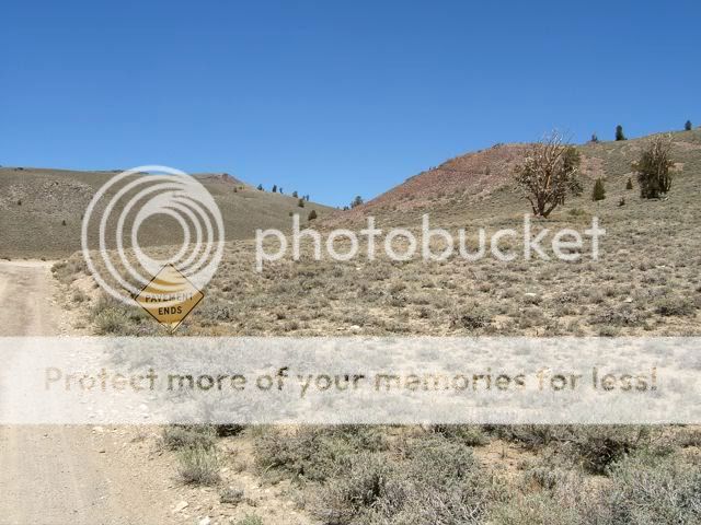
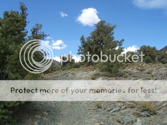
I started at the Schulman Grove (end of the pavement) while everyone else hiked, so there was only 2.5 miles of rolling terrain (total climbing of about 500') to get to the top. The elevation is 10,100-10,500'. The start of the dirt:
![Image]()
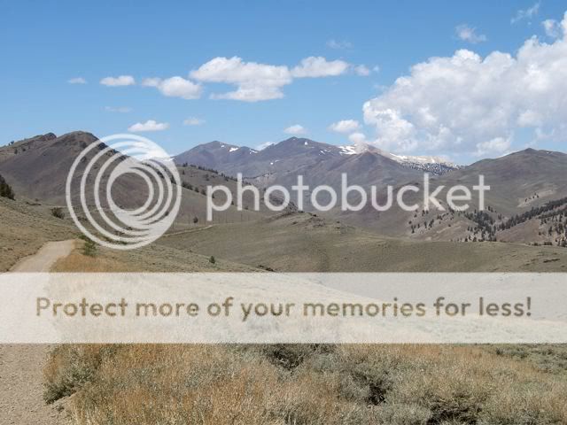
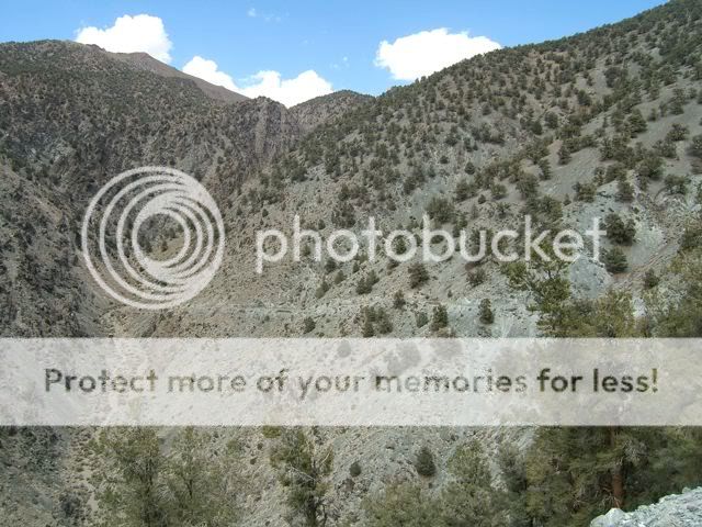
Looking north about a mile before Silver Canyon. The peaks are not White Mtn, although you can just barely see it (it looks like a tiny shoulder on the left side of the center peak, with a cloud behind it):
![Image]()
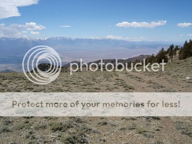
Turned left on the well-marked Silver Canyon road, and rode to the overlook (50 yds down the other side). Turned back around and rode to the top - this is the view you'd get if you rode up the Silver Canyon road to the very top. The old Silver Canyon road goes left on the old track past the No Motor Vehicles sign. This old road has been closed for decades to motorized traffic but is definitely legal for bikes (the recent Wilderness additions did not close it). A few motorcycles use it illegally now and then - just a single one since the winter.
![Image]()
The very top:
![Image]()
Heading down - you can see the old road ahead. Lots of sections of this road have handmade rock walls, and there's an old bridge near the top and an old cabin.
![Image]()
A bit further down - the road is long overgrown and it's pretty single-track in sections:
![Image]()
The old road (steep!), with Bishop in the distance. The high peak is Mt. Humphreys:
![Image]()
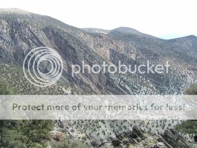
The modern Silver Canyon road is on the next major ridge to the south:
![Image]()
Some rock surface here and there:
![Image]()
Turning north towards the canyon bottom:
![Image]()
Looking back at the "road" - definitely not double track anymore!
![Image]()
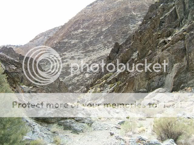
The main canyon ahead:
![Image]()
Nothing even approximating a solid tacky surface! Steep drop offs too:
![Image]()
Finally hit the wash - and time to kick out of techy-loose and into big rocks and gravel:
![Image]()
Heading down the canyon bottom - rocks, soft gravel, and tricky to find the best route:
![Image]()
Some faster sections:
![Image]()
When you hit the main road you can really fly, but watch out for the creek crossings!
![Image]()
Nearing the canyon mouth - Laws is straight ahead:
![Image]()
Hopefully you get picked up in Laws, I rode in the heat (not too bad) to a friends place across Bishop and waited a while before the hikers got back down! If you do this as an out and back up Silver Canyon, get started EARLY. I got going a couple times around 7 and would have done a lot better to start at 5 or even earlier. Of course if you're really hard core, you ride up Silver, north along the crest, up White Mtn (14,246'), and then back, for a total of 60 miles or more and around 12000' of climbing (over 10,000' even if there were no up & down along the crest!). Fun stuff!
Silver Canyon in the Whites, east of Bishop, is a heinous, brutal 6400' climb that tends to overheat 4x4s. The ridge top is 10,500'. As an up ride, it's actually not too bad of a surface, but down is a bit ugly - it tends to be very steep and kind of gravelly-slick, and there's also a fair bit of 4x4 traffic on the weekends. It was the original Kamikaze ride back in the day.
But - and here's the trick - there is the original Silver Canyon road, now more of a trail, which is a fun downhill. Especially if you cheat and get a car shuttle! Sunday was the 4th or 5th time I've ridden it, and the first time I lucked out and only rode a few hundred feet of uphill for the 6000'+ descent. The old road drops 4000' in 7 miles, then joins the modern road.
Warning - this is loose, steep, and remote. Only for folks who are used to loose desert surfaces!
I started at the Schulman Grove (end of the pavement) while everyone else hiked, so there was only 2.5 miles of rolling terrain (total climbing of about 500') to get to the top. The elevation is 10,100-10,500'. The start of the dirt:
Looking north about a mile before Silver Canyon. The peaks are not White Mtn, although you can just barely see it (it looks like a tiny shoulder on the left side of the center peak, with a cloud behind it):
Turned left on the well-marked Silver Canyon road, and rode to the overlook (50 yds down the other side). Turned back around and rode to the top - this is the view you'd get if you rode up the Silver Canyon road to the very top. The old Silver Canyon road goes left on the old track past the No Motor Vehicles sign. This old road has been closed for decades to motorized traffic but is definitely legal for bikes (the recent Wilderness additions did not close it). A few motorcycles use it illegally now and then - just a single one since the winter.
The very top:
Heading down - you can see the old road ahead. Lots of sections of this road have handmade rock walls, and there's an old bridge near the top and an old cabin.

A bit further down - the road is long overgrown and it's pretty single-track in sections:

The old road (steep!), with Bishop in the distance. The high peak is Mt. Humphreys:

The modern Silver Canyon road is on the next major ridge to the south:
Some rock surface here and there:
Turning north towards the canyon bottom:

Looking back at the "road" - definitely not double track anymore!

The main canyon ahead:
Nothing even approximating a solid tacky surface! Steep drop offs too:

Finally hit the wash - and time to kick out of techy-loose and into big rocks and gravel:

Heading down the canyon bottom - rocks, soft gravel, and tricky to find the best route:
Some faster sections:

When you hit the main road you can really fly, but watch out for the creek crossings!

Nearing the canyon mouth - Laws is straight ahead:

Hopefully you get picked up in Laws, I rode in the heat (not too bad) to a friends place across Bishop and waited a while before the hikers got back down! If you do this as an out and back up Silver Canyon, get started EARLY. I got going a couple times around 7 and would have done a lot better to start at 5 or even earlier. Of course if you're really hard core, you ride up Silver, north along the crest, up White Mtn (14,246'), and then back, for a total of 60 miles or more and around 12000' of climbing (over 10,000' even if there were no up & down along the crest!). Fun stuff!


